Mapping Sydney’s rat plague

Long before today’s coronavirus crisis and 18 years before the influenza pandemic of 1918-1919, Sydney was terrorised by a rat plague which began in China’s Yunan province in 1855 and spread here in 1900 via a ship that probably berthed at our Central Wharf (today’s Pier 6-7 Apartments).
Australia’s first case of bubonic fever was Thomas Paine, a carrier of export wool bales from East Darling Harbour warehouses to Central Wharf. He lived in a cottage at 10 Ferry Lane, which falls steeply from Windmill Street to what used to be the waterfront (on the south side of today’s Hickson Road). After being bitten on the ankle by a virus-carrying flea, he became too giddy to drive his horse-drawn cart, then suffered a strong headache, sharp stomach pains, a puss-filled swelling of his left groin, and a fever with vomiting.
Paine and his family were urgently ferried to the maritime quarantine station near the Sydney heads, where he began to recover after four days’ confinement. Meanwhile, four more people, all connected with the Huddart and Parker wharf near the corner of Sussex and Erskine Streets, were also infected with a disease that the government microbiologist, Dr Frank Tidswell, identified as Bacillus pestis bubonica.
In a paper for his walking tour of rat plague hot spots, historian Stephen Corbett noted that four ships, all with Chinese crews, berthed in Sydney in the three months before the plague began. These were the Prometheus, the Ching Wo, the Kaisow and the Kintuck. HMS Kintuck was berthed at Central Wharf from 9-20 January 1900, when Thomas Paine contracted his disease.
When the plague was proclaimed via newspaper reports and street posters, the NSW government’s Chief Medical Officer was Dr John Ashburton Thompson, who had been trained at Cambridge and in Brussels and had been an obstetrician and general practitioner in London before he emigrated in 1883 (perhaps to relieve tuberculosis). With his brother, Gerald, who was the art critic of The Sydney Morning Herald, Thompson publicised the danger of infections spreading through the unsewered and crowded slums that surrounded the Millers Point wharves.

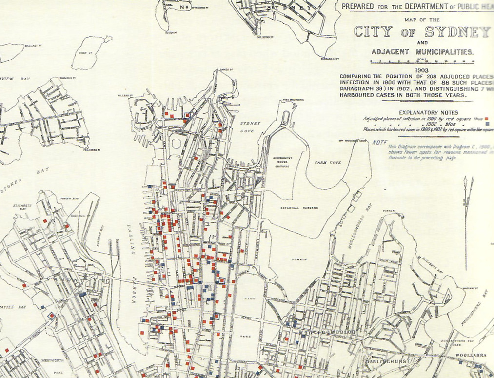
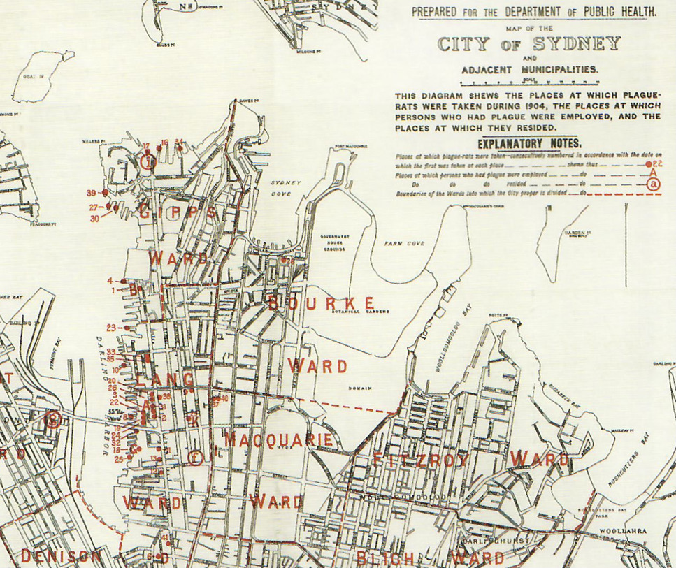
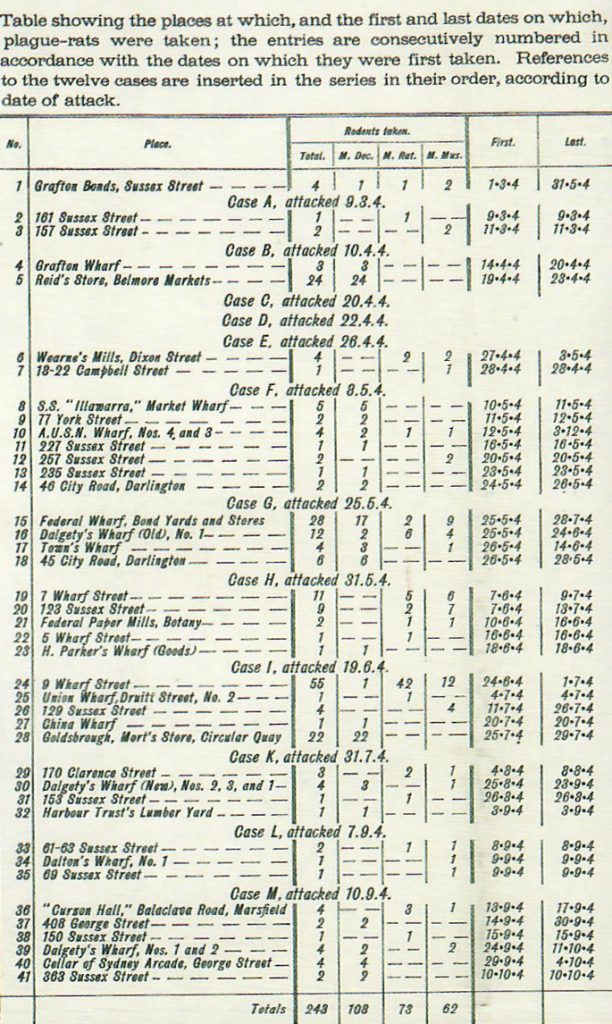
Thompson produced a series of plague maps and reports to the NSW Board of Health to clarify how the disease had arrived, was being transmitted, and could be quelled. Working in a golden age of discoveries of causes and remedies for microbiological diseases, he gained an international reputation for his contributions to modern systems of managing public health. His major innovation was a change of policy from quarantining diseased patients to campaigns to clean up places of infection (spraying streets and slums with disinfectant) and employing teams of men to catch and kill many thousands of rats.

Emeritus Professor Robert Clancy, a retired epidemiologist and leading collector of antique maps, has gathered all the plague outbreak maps and Board of Health reports that John Thompson produced to explain the four waves of plague that killed and sickened thousands of Sydney city dwellers from 1900 to 1905. This led directly to the government’s resumption and redevelopment of the slums of Millers Point and all the wharves and seawalls around Darling Harbour, from 1908 to 1925.
Further information
Stephen Corbett, n.d. The Plague Walk: Dawes Point to Darling Harbour (report).
