1826–1850: Dockland
As the colony at Port Jackson prospered, its cargo shipping facilities expanded west from Sydney Cove to the much larger deepwater zone that was first named Cockle Bay, then Darling Harbour. This shift began in the 1820s and included the waterfront between Dawes Point and Millers Point—today’s Walsh Bay.
Old maps and paintings show locations for some of the first commercial wharves. For example, John Carmichael’s 1837 ‘Plan of the town of Sydney’ noted Aspinall & Brown’s wharf between Kent Street and an unnamed road in the centre of the bay (matching the north-south part of today’s Pottinger Street). Pitman’s and Lamb’s wharves were near today’s Wharf 4-5 (Sydney Theatre Company) and Walker’s wharf was shown between today’s Pier One Hotel and Pier 2-3.
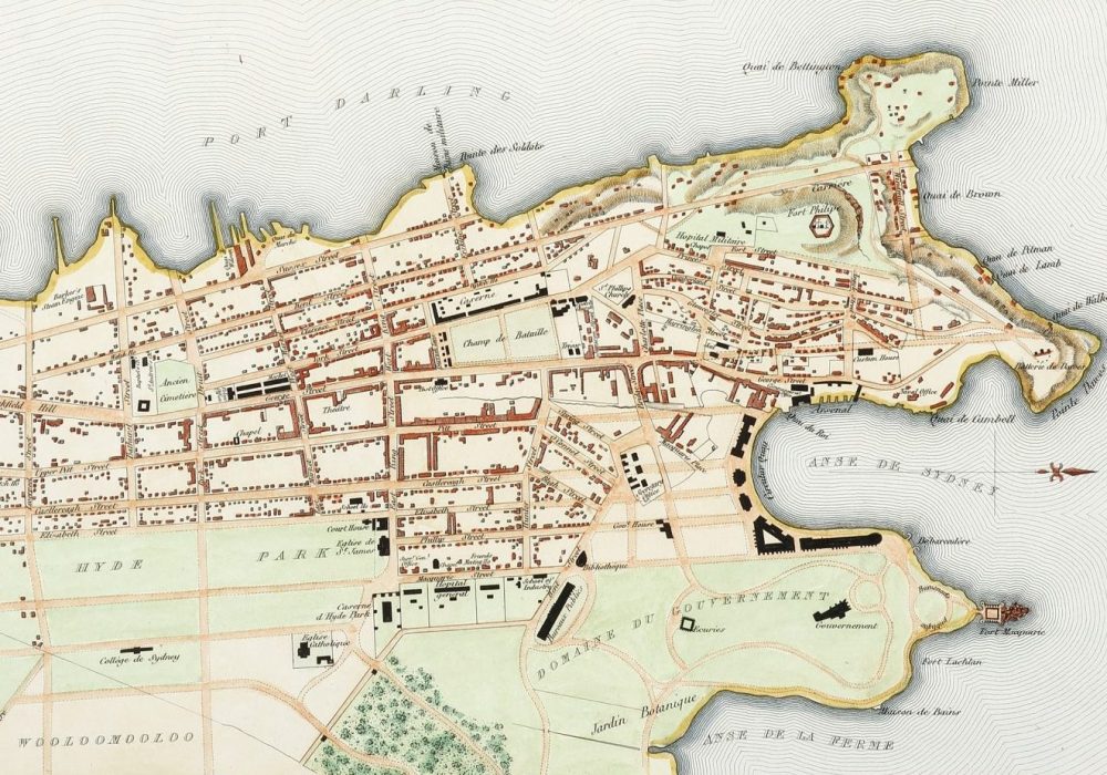
These four wharves also were marked on the 1838 ‘Plan de la ville de Sydney’ that was drawn aboard French frigate La Venus, captained by Abel Dupetit-Thouars, when it was anchored in Sydney during a late 1830s voyage to further French interests in the South Pacific. This map was superbly detailed; presumably drawn by the ship’s hydrographer, Urbain Dortet of Tessan.
From 1839 to 1843. the Australasian Chronicle regularly listed ‘Ships in Harbour’—giving details of the barques and brigs that were loading and unloading cargoes at Sydney’s wharves. Bales of wool were the main export cargo (mainly to English textile mills) but one wharf owner, Robert Towns, also exported timber and sandalwood to China, and Joseph Moore exported Waler horses to India. Other exports included coal, tallow, wine, whale oil, vegetable oil, copper, lead and gold from various NSW rivers. Imports included soap, candles, clothing, hardwood logs, machinery and household goods.
An 1845 map by city surveyor Francis Webb Sheilds showed Moor’s (Moore’s) wharf and Jones Wharf on the north-east shoreline of Millers Point and Batt’s wharf near today’s Wharf 4-5.
Sheild’s map marked in red but did not identify the town’s buildings—including various structures scattered around the waterfront north of Windmill Street.
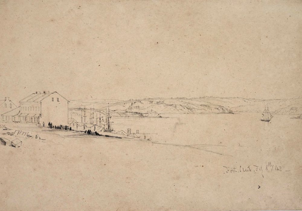
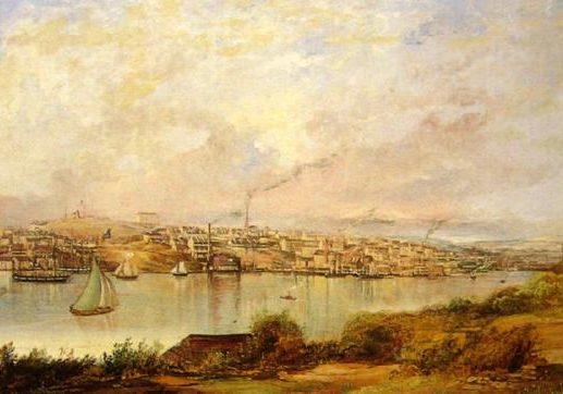
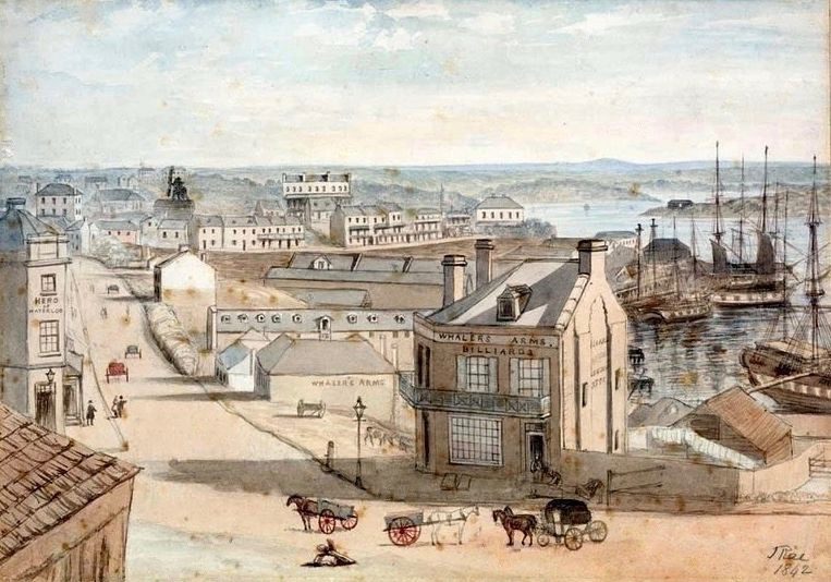
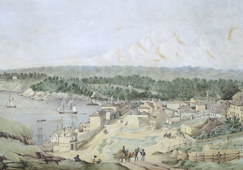
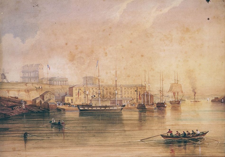
The 1840s architecture of the area is understood best by viewing four paintings below: A watercolour of Millers Point from Flagstaff Hill by convict artist John Rae (1842); a watercolour and gouache copy of Rae’s scene painted later by Arthur Collins; a watercolour view by Joseph Fowles looking north from Flagstaff Hill along Lower Fort Street to Dawes Point in the mid 1840s; and an 1847 oil painting by Frederick Garling of horses being loaded onto a ship at Moore’s wharf, with Moore’s imposing sandstone storehouse in the background. (This building was dismantled and rebuilt at today’s Port Authority of NSW tugboat dock on the eastern shore of Barangaroo Park.)
Rae’s watercolour best expressed the emerging cultural vibrancy of the Millers Point headland. In his foreground were two legendary pubs—the Hero of Waterloo and the Whaler’s Arms. Both were frequented by press gangs of hustlers who were paid to capture inebriated sailors to make up the crews of nearby trading ships. Although the Whalers Arms was converted to a corner store and residence, the Hero remains socially magnetic, along with various other colonial pubs in Millers Point and The Rocks.
Various scenes of ships and yachts sailing off Millers and Dawes Points were produced during the 1840s by Fowles, Garling, Conrad Martens, George Edwards Peacock, and John Skinner Prout.
For more details see ‘Painting the scene‘ in our Stories section.


