Bring ferries back to Walsh Bay
Walsh Bay has more wharves and jetties—plus more prestigious arts and culture venues—than any other shore of Sydney Harbour. So why is our city’s oldest colonial headland a blatant exclusion from the city’s network of public ferry stops?
Local campaigners, led by Yasmina Bonnet, vice-president of the Millers Point Community Residents Action Group (MPCRAG), are petitioning the state government to launch a new ferry boat service to connect Walsh Bay residents and visitors to other stops around the central harbour network. Local MLA Alex Greenwich is arranging a parliamentary e-petition to attract enough signatures to raise the issue with a relevant minister and possible debate in the House of Representatives.
The Walsh Bay Ferry Alliance claims that a new service would fill the current gap along our foreshore between existing stops at Circular Quay and Barangaroo—both 25-minute walks from central Walsh Bay. It might ease congestion on this peninsula’s limited road network and make our cultural venues more accessible and attractive for visitors.
One alliance committee member, former NSW Government Architect Chris Johnson, has suggested a new ‘hop-on, hop-off’ ferry circuit of existing wharves near tourist-magnetic venues including both major art galleries, Taronga Zoo, Luna Park/North Sydney Pool and the diverse attractions at Darling Harbour and Walsh Bay.
Some problems could delay or block a Walsh Bay ferry stop. Qualms include potential engine thruster noises interrupting performances and private functions at Piers 1–5 (although modern electric boat engines are quiet); intoxicated passengers annoying residents, visitors and workers at night; and possible interferences with other boats berthed at Pier 6/7 and the Port Authority’s quay.
As the new campaign kicks off, it seems timely to recall the history of ferries connecting our headland to other parts of the central harbour.
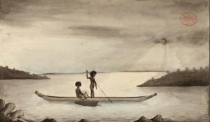
Because Walsh Bay’s eastern tip (Dawes Point/Tar-ra) is the south edge of the harbour’s narrowest passage, it was always a logical launch spot for nawi bark canoes and rowboats to take passengers and goods across to the north shore. This was a key carriageway between Sydney city and settlements further north—long before the harbour bridge joined the CBD to North Sydney in 1932.
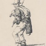
Sydney’s first regular colonial ferry service was operated between Dawes and Blues points by the gregarious Black American slave-convict-seaman, ‘Commodore’ Billy Blue. Beginning with one rowboat after arriving on a transport ship at Sydney Cove in 1801, he grew a fleet of 11 ferries, especially while he was patronised by Governor Lachlan Macquarie from 1810 to 1821.
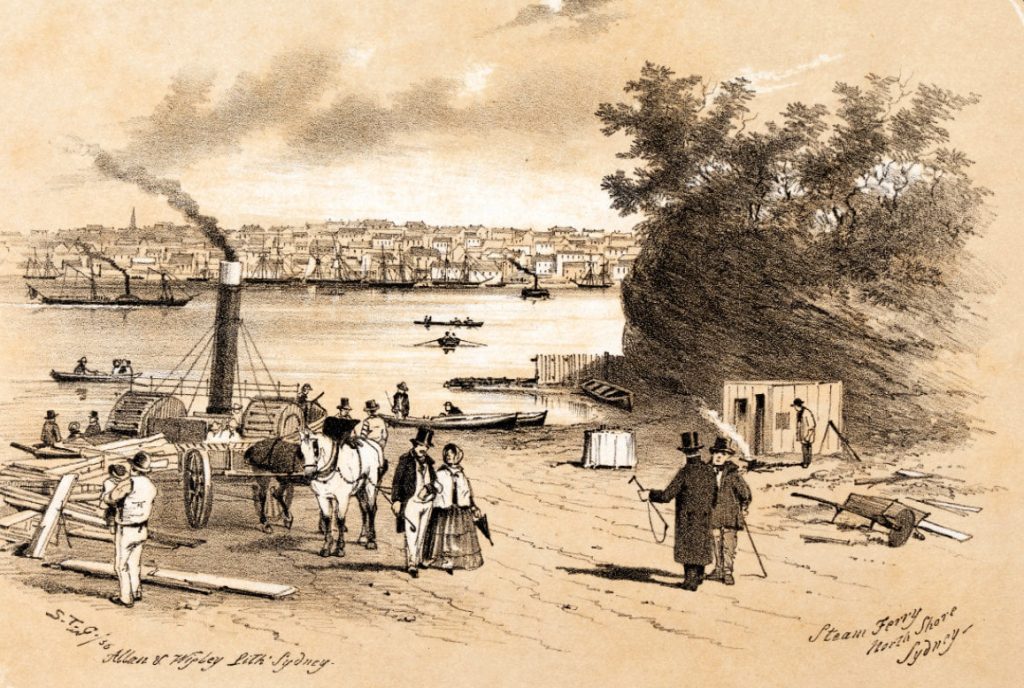
Canoes, rowboats and sail craft continued to link the north and south shores after Billy Blue died in 1834. Then in March 1842, the first steam-powered punt, the Princess, began ferrying horses, carts, carriages and some passengers and other cargoes, from a jetty at the foot of Ferry Lane, off Windmill Street, to Blues Point. Tickets cost threepence per human with one horse and two pounds sixpence for four-wheeled vehicles pulled by two or more horses. Because this daylight service proved unprofitable, the Princess was sold in 1843 and its engine was converted to run a flour mill near Maitland.
The early 1840s was a crucial decade for Sydney, before the gold rush and wool boom transformed the nation’s economy. In May 1840, the British Government formally ordered an end to transports of convicts to New South Wales. Although an economic depression bankrupted some citizens during the next few years, fresh winds of maturity and prosperity were also blowing. In 1842, the colony established its first local government, the City of Sydney Council, with John Rae, a noted painter of local street scenes, as the first town clerk. And Millers Point nightlife flared when William Wells converted his Argyle and Kent streets home to the Lord Nelson Hotel in 1841, then Thomas and Anne Kirkman opened the Hero of Waterloo pub at Windmill and Fort streets in 1843.
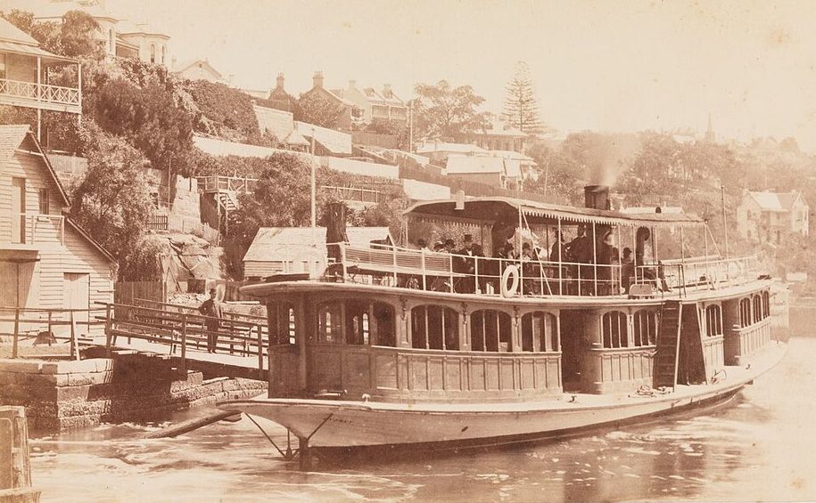
The Lord and Hero were convenient meeting places for people using a new steam ferry, the Fairy Queen, which two brothers, Thomas and James Gerrard, ran on request between Windmill Street and Blues Point from 1845. Windmill Street was the main road nearest to jetties at the base of two steep and narrow walkways: Ferry Lane and the original (upper) stretch of Pottinger Street.
Sydney’s historical records of late-19th century ferry services seem precise about the boats, but inconsistent with names of owners and operators. For example, some reports spell the Gerrard brothers as John and Joseph Gerard, and research writers differ about which boats they owned and when.
Old newspapers record that in 1847, the Gerrard brothers imported British parts to locally assemble a small side-paddle steamer, the Brothers, which briefly took passengers from Windmill Street to Blues Point; then was rerouted to serve Manly.
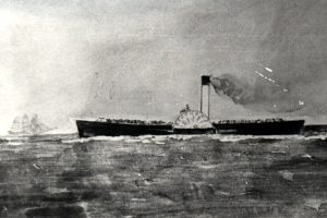
In 1855, a new North Shore Steam Company built an iron paddle steamer, the Herald, to run a regular service between Dawes and Blues points. This company changed ownership and name several times during the next few decades, as it acquired new steamships and launched more north shore services. In 1879 it introduced the city’s first double-ended screw ferry, the Wallaby, which did not require churning around to reverse direction.
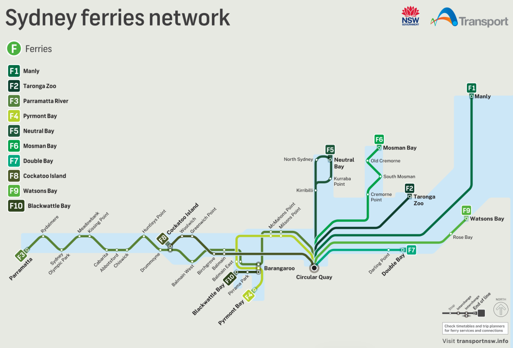
After buying out several smaller ferry companies, the renamed North Shore Steam Ferry Company was reformed as Sydney Ferries Limited. It continued absorbing smaller operations to become Sydney’s largest ferry operator in the early to mid-20th century. But it became unprofitable after the Second World War and was acquired by the NSW Government in 1951. Today, Sydney Ferries is leased and operated by Transdev Australasia via the government’s Transport for NSW department. Two CBD nodes are currently active—Circular Quay and a pair of stylish new wharves at South Barangaroo.
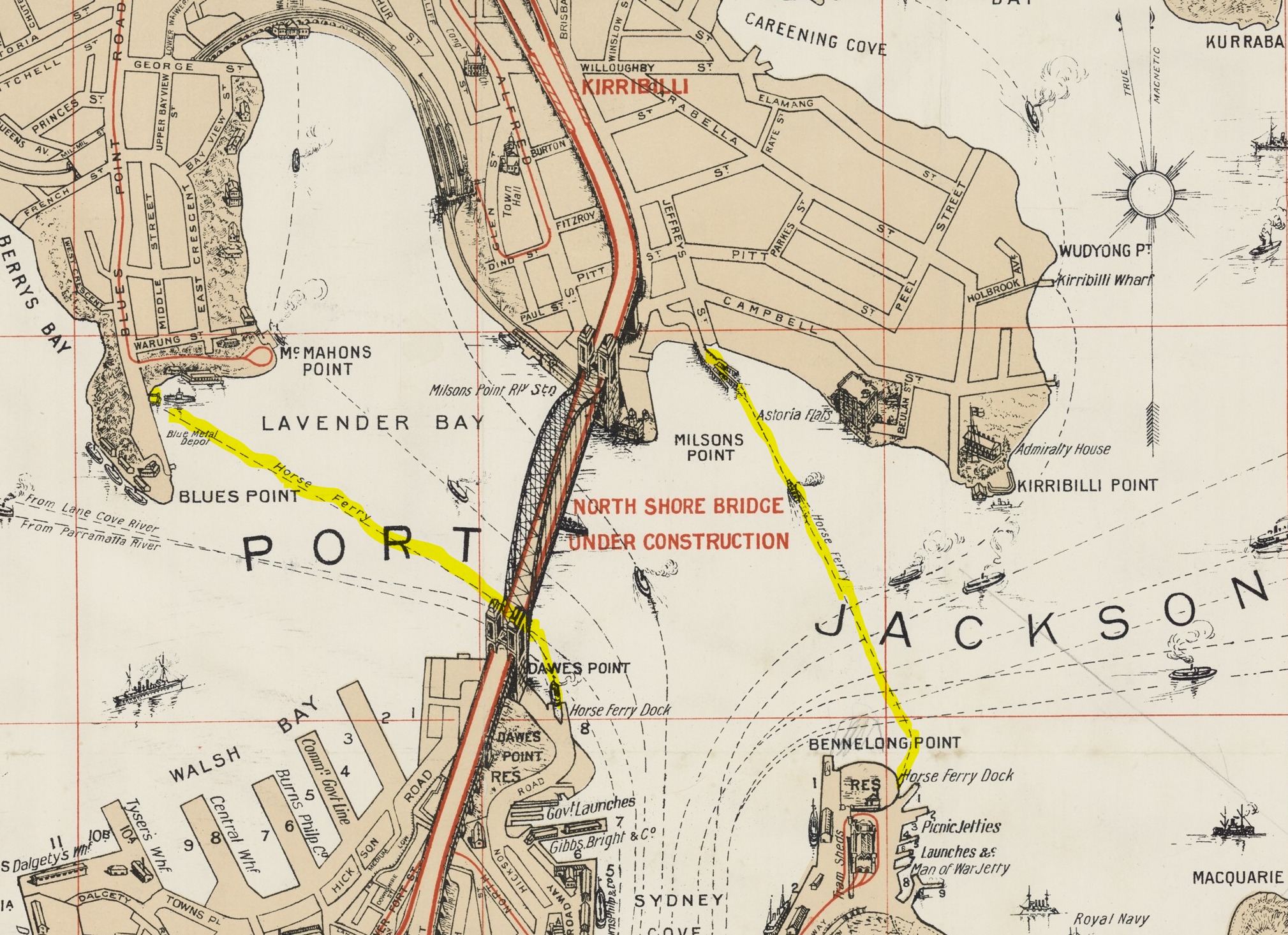
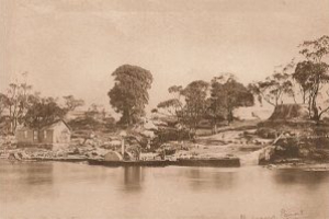
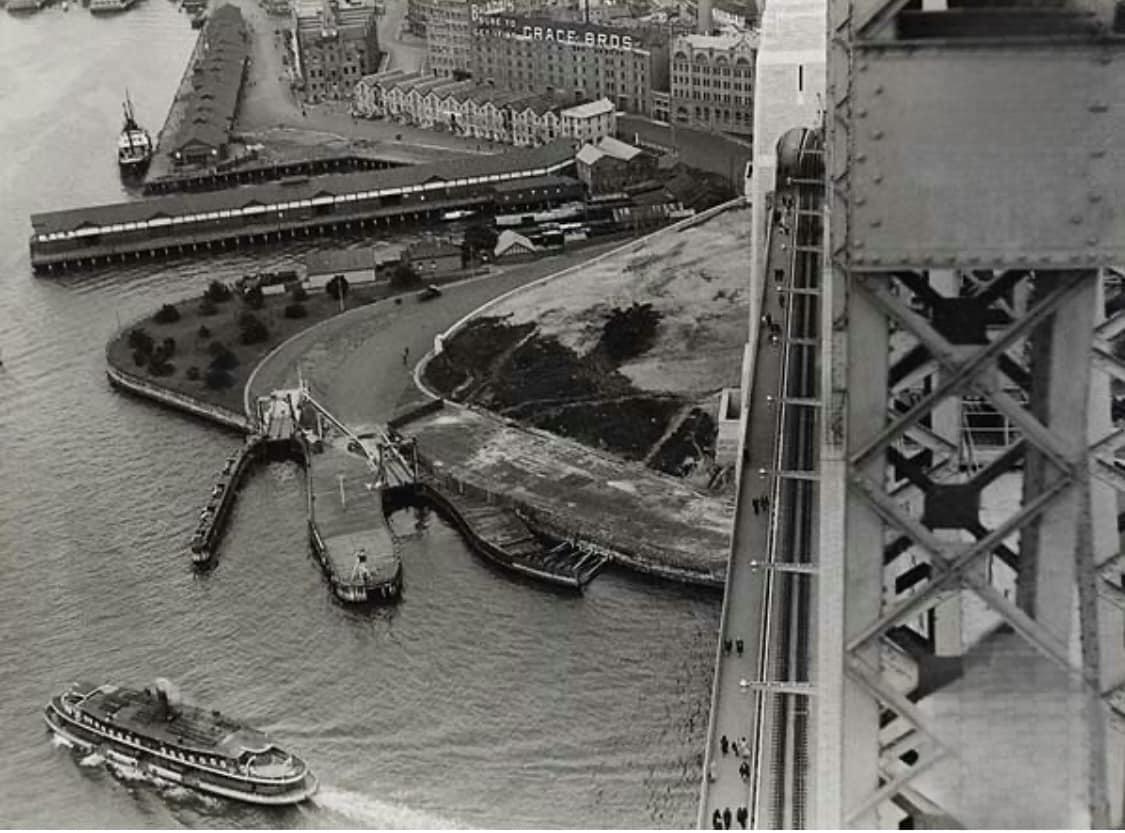
If you’re walking around the eastern tip of Dawes Point Park today, you’ll see the hard-edged indent of a historic cobblestone boat ramp. This is a remnant of one of the two south docks for the city’s regular horse ferry—a motor punt service which took people, livestock and vehicles to and from Blues Point from around 1901 until the bridge was opened in 1932.
This route began operating soon after a devastating rat plague in 1900, which required the government to resume, demolish and rebuild most slum housing around The Rocks. A new Sydney Harbour Trust also reclaimed a wide strip of foreshore to build new freight roads, concrete sea walls, modern double-decker wharves and multi-storey warehouses around the entire perimeter of Darling Harbour and Blackwattle Bay.
Walsh Bay and Hickson Road were named after the two government engineers—Robert Hickson and Henry Deane Walsh—who designed and managed this major maritime infrastructure project from around 1901 to 1924.


Continuing through these era-defining upheavals, the Dawes Point horse ferry finally closed a fortnight before the new harbour bridge opened to motor traffic on 1 April 1932. By then, most passenger ferries were operating from the central hub of wharves at Circular Quay, while Walsh Bay’s wharves were reserved for international cargo ships and some ocean liners.
After the Second World War, the Walsh Bay wharves were obsolete for modern ships. The area was shrouded by wire fencing and abandoned to vandals until the mid 1980s, when the Wran government began a still-progressing project to revitalise this historic waterfront as a vibrant cultural, commercial, recreational and residential precinct.
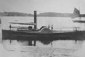
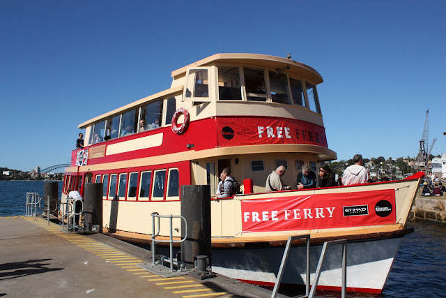
One contribution to our headland’s rejuvenation has been free ferry services between Walsh Bay, Circular Quay and Cockatoo Island during several Sydney art biennales. Three small ferries—the restored vintage Royal, Regal and Proclaim—shared daily shuttles which temporarily activated the floating jetty beside Pier 2. While Cockatoo Island still berths ferries scheduled 22 times each weekday and 17 times daily on weekends and public holidays, Walsh Bay remains absent from the Sydney Ferries schedule.
Although Walsh Bay’s streetlife is diminished by some vacant shops along Hickson Road and the waterfront, and neaby road closures and detours don’t help magnetise audiences for our publicly funded performance venues, the precinct has been transformed into one of the world’s most enchanting urban waterfronts. It’s especially enriched by the new Barangaroo metro station and the MPCRAG-advocated Marrinawi swimming cove.
Still to come are the central Barangaroo park and mixed-use precinct—long delayed by MPCRAG’s opposition to proposed tall buildings blocking views from heritage terrace houses—and the Cutaway cultural centre beneath Barangaroo Park. Other suggestions include a hotel in the historic Dalgety headquarters at Munns Street, and water sports activating Nawi Cove beside the metro station.
The Marrinawi Cove excavation only recently reproduced an ancient inlet that was historically filled in by the 19th-century Cuthberts shipyard and 20th-century Patricks cargo wharf. Like the smaller Marrinawi Cove, it was rescaped as a ‘city beach’ to encourage people to relax and swim around its stepped sandstone edges; although Barangaroo bureaucrats have been slow to permit aquatics.
After decades of diatribes against every new building development, most locals and visitors now reckon it’s pretty-much paradise around the Walsh Bay-Barangaroo waterfront. But there’s one sad paucity. Where are chances to experience (not merely watch) the thrills of being afloat on our wonderful harbour?
Lets put Walsh Bay on the Sydney Ferries map and timetable. Sign the parliamentary petition.
Further Reading
Andrews, Graeme, 1975, The Ferries of Sydney. Sydney: A.H. & A.W. Reed.
Andrews, Graeme, 1982, A Pictorial History of Ferries: Sydney and Surrounding Waterways. Sydney: A.H. & A.W. Reed.
Gunter, John, 1978, Across the Harbour: The Story of Sydney’s Ferries. Adelaide: Rigby.
Prescott, A.M., 1984, Sydney Ferry Fleets. Magill, SA: Australian Maritime History Society and Ronald H. Parsons.